CENTRAL PASILA URBAN DESIGN MANUAL
The goal of Central Pasila Street Design Manual has been to create new character and appearance to support the new identity of the area. The project serves as basic guidelines for the main streets and public spaces, and defines the urban design and landscape structure of the area, to support the preparing of the master plan.
The work as an initial concept emphasizes the high quality traffic and pedestrian environment, as well as and clarity, attractiveness and comfort in the public areas of a new central business and service district, to be built on an old railway freight area.
Climatic conditions are an essential part of the study – Pasila being notably windy during all seasons. The manual suggests using trees where possible, or other wind-moderating means, such as fence or wall structures.
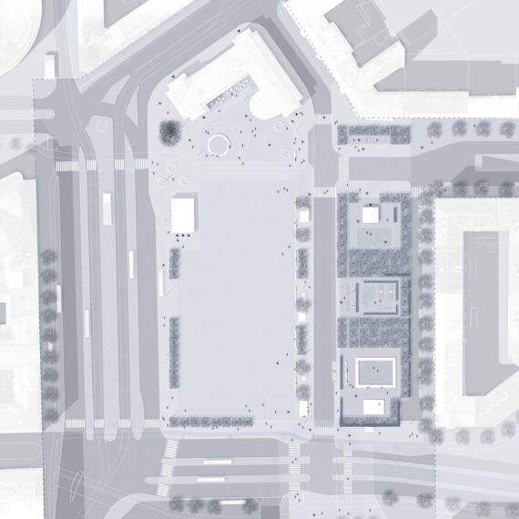
The plan studies the street hierarchy, the most significant street spaces, crossings and the different traffic flows on the site in the vibrant transport hub of northern Helsinki, and takes a stand on where high quality urban design should be implemented. Street profiles, shared space streets and squares as well as a plan for vegetation are included in the design manual.
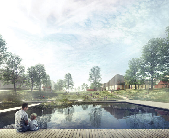
The plan defines new main pedestrian paths that interact with pleasant spaces for lingering and meeting. The square-like crossings on the main street Pasilankatu form urban spaces, and the study emphasizes their importance. The Pasilansilta bridge also hosts interesting vantage points, which the plan suggests to be taken into account as stopping places, especially with the future tower house district that will be built over the rails.


Wind Conditions

Vantage Points and Pleasant Microclimates

Pedestrian Flows

Vegetation Plan

Pasilansilta
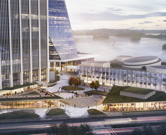
- The most central streetscape of the planning area is Pasilansilta and the squares relating to it. Its urban design and appearance link together the western, central and eastern Pasila and functions as a significant public transport hub for both near and long distance trains, buses and trams.
- Most of the new commercial and business premises are located in the new city block and tower houses framing the old station bridge.
- A distinguishable, sculptural canopy redefines the station square.


Pasilankatu
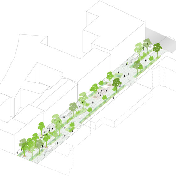
- Pasilankatu –street orientates itself more to the local Pasila surroundings than the bridge. It forms a boulevard-like, authentic streetscape, reminiscent of the inner city, where rows of trees dominate the appearance.
- Due to scarce parking on the street a relatively narrow street profile is possible.
- Square-like traffic roundabouts give rhythm to Pasilankatu. Commercial services are centralized in vicinity of the roundabouts.


A view from Pasilankatu. Plant beds are placed in an alternating rhythm to form interesting and varying views.
Veturitie
- Veturitie is a regional collector street and serves both as a transit through road and as a local connecting street. The transit traffic is directed to a canyon and tunnels, where Veturitie meets the central city block.
- Veturitie runs through the entire planning site, and is divided into sections with different structure motifs. The spatial challenges issued by busy, long and short distance traffic are taken apart and transformed into positive features. Representations of these features are for example the multilevel traffic roundabout by the central city block, the tunnel section passing underneath Pasilansilta Bridge, and in the northern part of Veturitie a wall element framing the railway chasm.
- The plan strives to soften the general appearance of the busy Veturitie with continuous and unbroken planting of trees in the most central areas. Furthermore the plan emphasizes a slowing down of the street’s atmosphere when arriving to the central city block.